

Borehole Drilling in Nakuru: Expert Guidance from Menengai Drilling Ltd
If you're a landowner, real estate investor, developer, or institution planning borehole drilling in Nakuru, choosing the right approach is essential.
The distinct geology of Nakuru County, which is primarily composed of hard volcanic rocks from the Rift Valley, necessitates specialised knowledge to prevent expensive failures in borehole drilling.
At Menengai Drilling Ltd, we position ourselves as the geological authority in the region, drawing on years of experience across Kenya's Rift Valley to deliver reliable, sustainable water solutions.
Our focus on site-specific hydrogeological assessments and advanced drilling techniques ensures success where others struggle.
This guide explains the technical realities of borehole drilling in Nakuru, why local ground conditions require proven methods, and how to proceed confidently.
The Local Geological Profile of Nakuru County
Nakuru County lies within the Great Rift Valley, characterized by Tertiary-Quaternary volcanic rocks such as trachytes, phonolites, basalts, tuffs, and pyroclastics.
These formations originated from extensive volcanic activity, resulting in extremely hard, dense, and fractured rock layers that pose significant challenges for water access.
Unlike softer sedimentary or alluvial soils found in coastal or riverine areas, these volcanic rocks limit natural permeability.
Aquifers are often confined to fractured zones, weathered layers, or porous tuff and pumice horizons where water collects.
This geology explains why shallow hand-dug wells are rare and unreliable in Nakuru—successful boreholes require penetrating thick, unfractured rock to reach viable water-bearing zones.
Areas like Nakuru town, Kabatini, Njoro, Gilgil, and Naivasha often encounter these conditions, with groundwater heavily influenced by the volcanic terrain.
Understanding this profile is the first step to avoiding dry or low-yield holes.
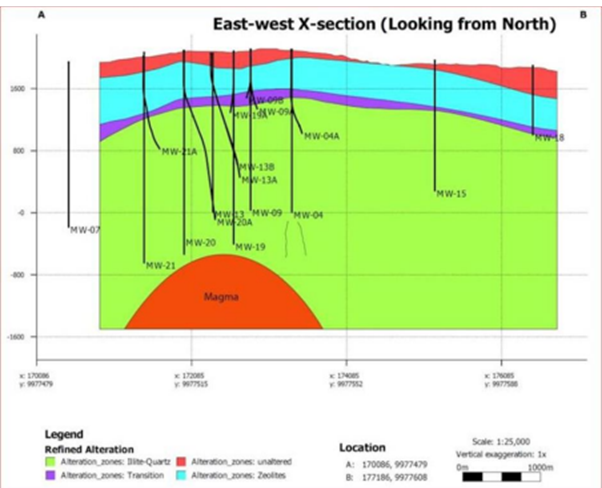
Geological Cross-Section of Rift Valley Volcanic Structures
Source: volcanohotspot.wordpress.com (Menengai Crater geological cross-section, relevant to Nakuru's volcanic geology)
Hydrogeological Survey in Nakuru: The Essential First Step
No responsible borehole drilling in Nakuru begins without a professional hydrogeological survey in Nakuru.
This scientific assessment uses geophysical methods—such as resistivity and seismic surveys—to map subsurface structures, identify fractured zones, estimate aquifer depth, and predict water quality.
Skipping this step risks drilling blindly, leading to dry holes or contaminated sources.
At Menengai Drilling Ltd, our surveys are conducted by qualified hydrogeologists who interpret data against Nakuru's volcanic geology.
We pinpoint optimal drilling sites, reducing uncertainty and maximizing yield.
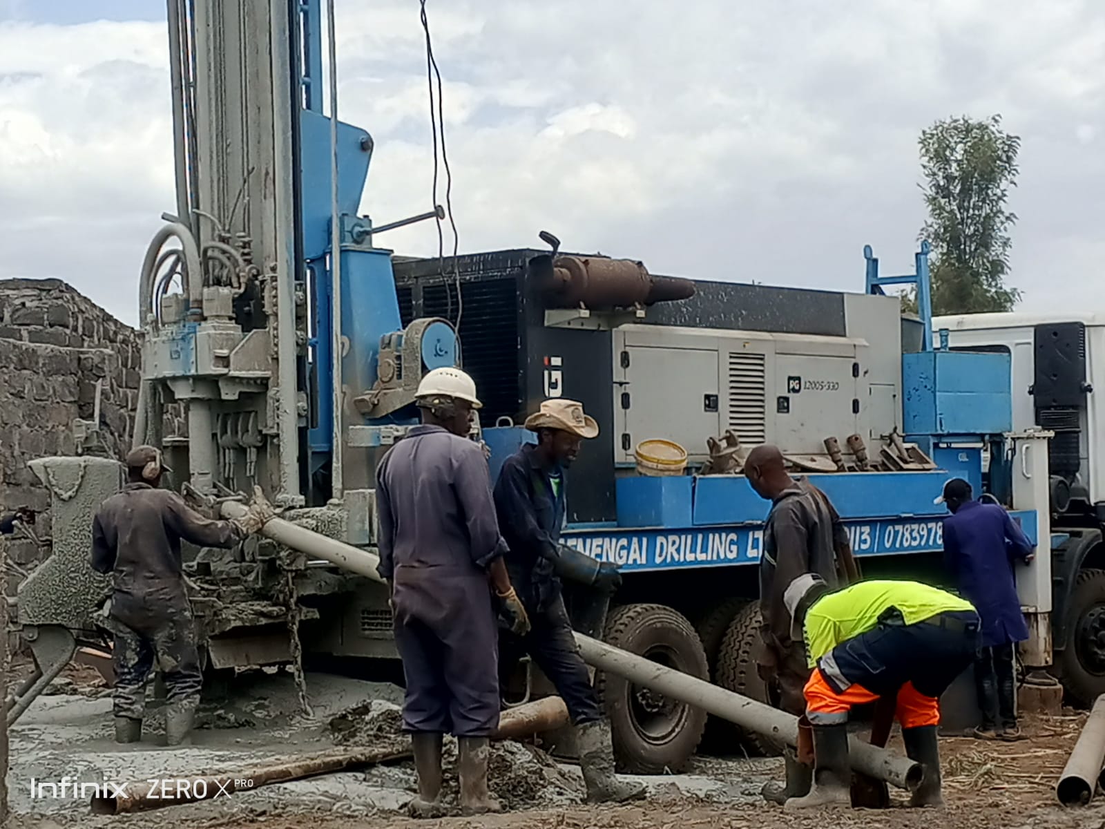
Engineering Strategy: Why DTH Drilling is Non-Negotiable in Nakuru
Traditional mud rotary drilling works well in soft soils but fails in Nakuru's hard volcanic rocks.
The abrasive nature causes excessive bit wear, deviation ("wandering"), and hole collapse, often stalling progress or resulting in unstable boreholes.
The solution is Down-The-Hole (DTH) drilling.
In DTH, a pneumatic hammer at the drill bit's end delivers high-frequency impacts powered by compressed air.
This shatters hard rock efficiently while maintaining straight, stable holes.
Menengai Drilling Ltd relies on DTH rigs tailored for Rift Valley conditions, delivering faster, more reliable results in trachytes, phonolites, and tuffs.
Mapping the Aquifers: Depth Expectations and Challenges in Nakuru
Groundwater in Nakuru is highly variable.
Boreholes typically reach 100–350 meters, depending on location, fracture networks, and weathered zones.
Some areas strike water at shallower depths in fractured volcanic layers, while others require deeper drilling to access confined aquifers.
A major concern is water quality—many boreholes in Nakuru show elevated fluoride and salinity due to volcanic influences.
Studies and water quality reports indicate fluoride levels frequently ranging from 2–10 mg/L (and sometimes higher), well above the WHO and KEBS safe limit of 1.5 mg/L.
Water quality testing post-drilling is mandatory to confirm levels.
Reverse Osmosis (RO) Systems: The Reliable Solution for High-Fluoride Borehole Water
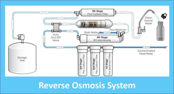
Reverse Osmosis (RO) systems provide the most effective treatment for borehole water contaminated with high fluoride, TDS (total dissolved solids), salinity, and other dissolved minerals prevalent in Nakuru.
RO works by forcing water under pressure through a semi-permeable membrane that rejects fluoride ions and other contaminants while allowing clean water molecules to pass.
Key benefits of RO for Nakuru borehole water:
- Highly effective fluoride reduction to below safe limits.
- Removes salinity and improves taste.
- Comprehensive purification against volcanic-derived contaminants.
- Suitable for domestic, institutional, or small commercial use.
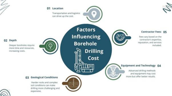
Cost of Drilling a Borehole in Kenya: What to Expect in Nakuru
The cost of drilling a borehole in Kenya varies by depth, geology, and services.
In Nakuru, rates often range from KES 6,000–10,000 per meter (drilling only).
Borehole Drilling Services in Nakuru: Permitting and Compliance
- Hydrogeological Survey Report
- Proof of Land Ownership or Access Rights
- Application for Drilling Permit from WRA
- NEMA Environmental License
- Post-Drilling Completion Certificate and Water Quality Testing
Book Your Hydrogeological Survey in Nakuru
Don't guess what's under your feet in Nakuru's volcanic terrain.
Contact Menengai Drilling Ltd today to schedule your geological assessment.
📞 0722368773
📧 menengaidrillingltd@gmail.com